Palakkad - Celebrated as the granary of Kerala, Palakkad is a vast expanse of verdant plains interspersed with hills, rivers, mountain streams and forests. The gateway to Kerala from the north, a 40 kilometre break in the mountains known as the Palakkad Gap gives access to this land situated at the foot of the Western Ghats. The pass acts as a corridor between Kerala and neighbouring Tamil Nadu and played a major role in the trade contacts between east and west coasts of peninsular India.
Deriving its name from the Malayalam words Pala (Alsteria scholaris) and Kadu (forest), this place was once a beautiful stretch of forest covered with the sweet-scented flowers of the Pala tree. A potpourri of Tamil and Kerala culture, some of the finest Carnatic musicians hail from this region which continues to be a largely agrarian society.
Palakkad District Map :

Palakkad Fort (Tipu’s fort) – Granite fort built by Hyder Ali in 1766. One of the best preserved forts in Kerala. Martyr’s Column & open-air auditorium are in the spacious fort grounds. A children’s park is on one side.

Deriving its name from the Malayalam words Pala (Alsteria scholaris) and Kadu (forest), this place was once a beautiful stretch of forest covered with the sweet-scented flowers of the Pala tree. A potpourri of Tamil and Kerala culture, some of the finest Carnatic musicians hail from this region which continues to be a largely agrarian society.
Palakkad District Map :
Palakkad Fort (Tipu’s fort) – Granite fort built by Hyder Ali in 1766. One of the best preserved forts in Kerala. Martyr’s Column & open-air auditorium are in the spacious fort grounds. A children’s park is on one side.
Kalpathy Siva Temple
– 700 year old Viswanatha Swamy temple on the banks of river Kalpathy. Known
for annual chariot festival in November.
Jain Temple – 32
X 20 feet granite temple has images of Thirthankaras & Yakshinis.
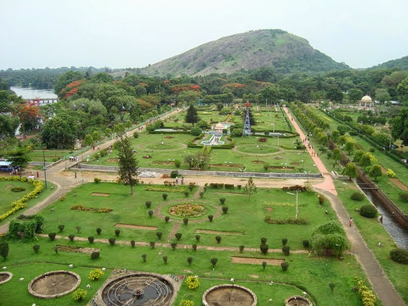
MALAMPUZHA Dam (10 km) – Garden complex around Malampuzha dam draws large
holiday crowd. Gigantic sculpture of ‘Yakshi’ (enchantress) – masterpiece of
famous sculptor Kanai Kunhiraman. Small Japanese style rock garden, rose
garden, boating facility in reservoir, rope way, hanging bridge across canal,
aquarium. Fantasy Park at Malampuzha has variety of rides - pirate boat, tora
tora, water merry go around, etc.


Lakkidi (near
Ottappalam) – Killikkurissimangalam is birth place of Kunjan Nambiar,
Kerala’s satirist poet, regarded as progenitor of Ottan thullal, a form of solo
dance narration. Poet’s house is preserved as a memorial by the Kerala
Government.
Dhoni (15 km) –
Hill station & trekking spot. Takes 3 hours trek from the base of Dhoni
hills to reach this reserve forest area, with its small waterfall. Also
farmhouse with Swiss cattle.
Kollengode (19 km)
– Has palace and Vishnu temple.
Chittur (15 km south
east) – Known for Kongappa festival in February – March. The festival commemorates
the victory of
Nairs of Kochi
over the militia
of Kongunadu (Coimbatore).
Chittur is also known for Kora grass mat making and granite carving. Chittur
Gurumadom or Thunchath Acharyamadom – Memorial to Thunchath Ezhuthachan, the
author of Adhyatma Ramayana.
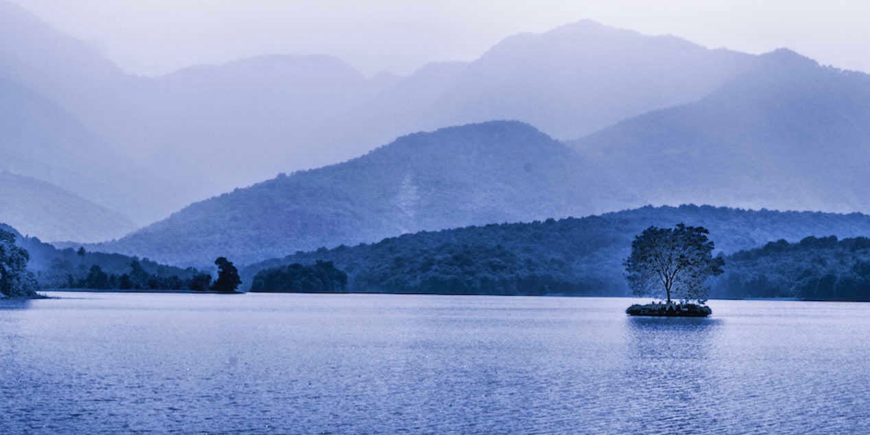
KANJIRAPUZHA (24 km)
– Reservoir of Kanjirapuzha dam. Evergreen forest ‘Vethilachola’ provides
backdrop to the lake surrounded by hills.
Alattur (24 km
south-west) – Alattur or Velimala hill has ruins of an ancient temple atop
the hill & a perennial natural spring. It also has a cave in the middle
with mud partitions.
Meenkara (32 km)
– Panoramic lake and aquarium.
SILENT VALLEY
National Park (80 km) - Substantial stretch of evergreen rain forests.
Transportation is possible only up to Mukkali (24 km from park). Rest of the
way has to be covered by foot. Visitors are allowed only in a few places in the
buffer zone. Facilities are rudimentary. Home of tribal people. Known for rare
lion tailed macaque.


PARAMBIKULAM Wildlife
Sanctuary (135 km) – Has the largest population of wild gaur (bison).
Boating facility in Parambikulam reservoir. Trekking is allowed with prior
permission. Kannimaram teak tree, said to be the largest in Asia is near
Thunakadavu, headquarters of Parambikulam.

Attappady (38 km from
Mannarkad) – Highland terrain with plantations & forests, fed by
tributaries of river Cauvery. Largest tribal settlement in Kerala. Habitat of
tribes like the Irulas & Mudugars. Malleshwaram peak is worshipped as a
giant ‘Shivalinga’ by the tribals.
NELLIAMPATHY (75 km)
– Hill station in Nelliampathy forest range, view of misty mountains &
valleys interspersed with tea, coffee, cardamom, orange & teak plantations.
Vantage view point with 100 m high waterfall near Seethagundu estate. Hills’
heights - 467 m to 1572 m (Padagiri or Nellikota peak). Trekking potential.
Camping in community hall at Kaikatty.

Pothundy (17 km from
Nelliampathy) – Pothundy reservoir complex – picnic spot and stop over
point enroute to Nelliampathy.
Thrithala (75 km)
– Kathil Madom temple on the banks of Bharathapuzha river is a domed structure
of granite slabs built in the 9th /10th century. Marks transition from Chola to
Pandya style of architecture. Nearby are ruins of a large fort with deep moat
hewn out of laterite.
No comments:
Post a Comment